Detailed Weather
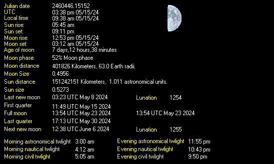
The Current Trends, Conditions, Wind Rose (Direction), 24 and 72 hour graphs, Sun Moon, Wind Direction, and Wind Energy are provided by our station based in West Lethbridge. You can also view Radar and satellite images, or a detailed view of our station console. Below is the detailed information from our program, Weather-Display, which has generated weather graphics and weather details for our website. A shout-out to the folks at Weather-Display for this great program that we have used since our site was launched in 2008. Don’t get scared by the amount of data and charts, once you take a closer look you’ll see it’s easy to read! Have a look below, and learn a little more about the weather.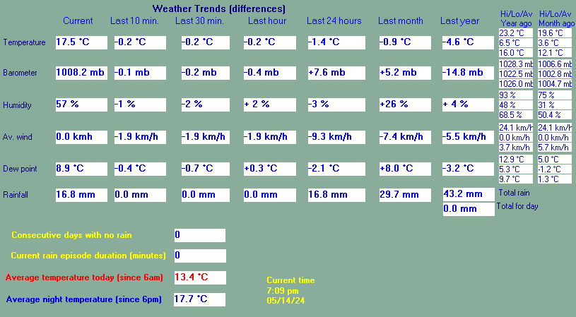
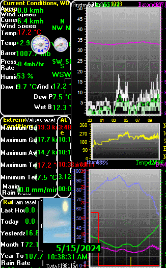
This is the station console view from Weather-Display that allows an at a glance look at all the information in one in depth view. For a larger view of the 24 and 72-hour graphs, see below.
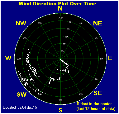
This wind rose shows wind direction over the past 12 hours. (The oldest data is in the centre of the image).
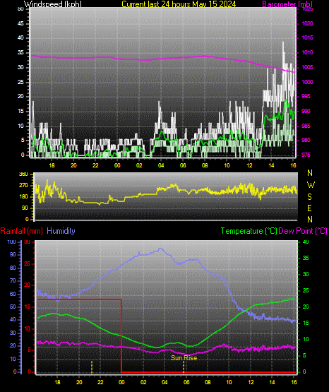
This graph shows windspeed, barometer, temperatures, humidity, and dewpoint over the last 24 hours.
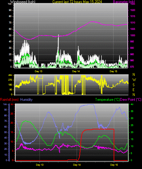
This graph shows windspeed, barometer, temperatures, humidity, and dewpoint over the last 72 hours.
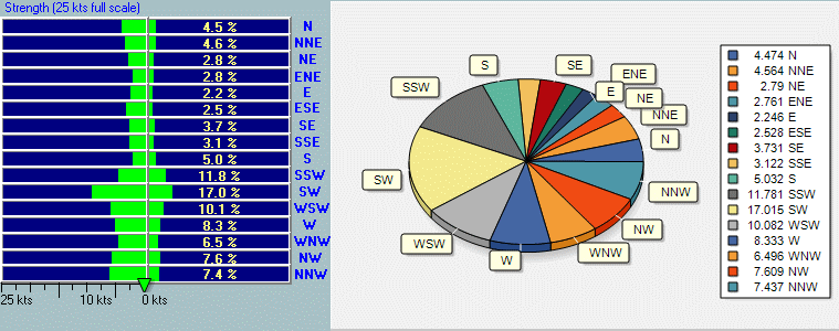
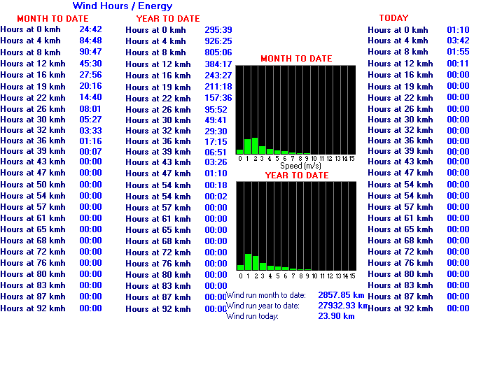
Here you can see how much potential wind energy is produced at the station at that windspeed.
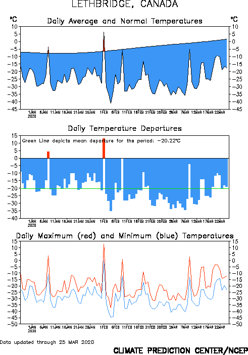
Daily average and normal temperatures for Lethbridge showing above or below normal from the Climate Prediction Centre.